The marker where the corners of Nevada, Arizona and Utah come together, just north of Mesquite, and the place that gives the Tri-State area its name.
Mesquite and the Virgin Valley Where Berg found an abandoned rock cabin after driving past the spot dozens of times: the hidden history the book was written to point out.
The City of Mesquite's museum, the research stop behind much of the book's history, and the first name in its acknowledgments.
South of Mesquite and Bunkerville
Gold Butte National Monument
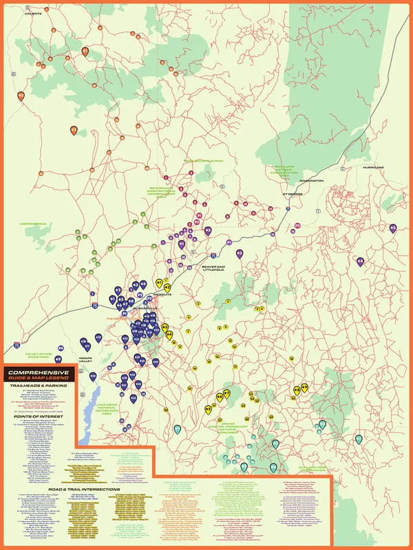
The book gives it two chapters, "Gold Butte: A Geological Marvel in the Southwest" and "The Wild Burros of Gold Butte: Mesquite's Silent Builders", and the area guide map marks 33 points of interest around it, Whitney Pocket, Little Finland and Devil's Throat among them.
Moapa Valley
The Lost City and St. Thomas
Two chapters in the book's first historical part, "Echoes of Ancient: The Lost City" and "St. Thomas: A Journey Through Time"; the map marks St Thomas Ghost Town, and the Lost City Museum is on the resources page.
Virgin Valley
Bunkerville
Settled in 1877 according to the book's timeline, with its own chapters: "A Line in the Sand: Bunkerville & the Struggle for Sovereignty" and "Mesquite Amidst the Mushroom Clouds: Echoes from Bunkerville's Past".
Arizona Strip
Pakoon Springs
From the fact sheet: just 30 miles south of the city, it once held not only 500 ostriches but a real-life alligator in the desert.
Lincoln County, Nevada
Lincoln County and Caliente
Region C of the book's trails and destinations section (from page 130). The map reaches up to Caliente and marks Pine Canyon Dam, the Elgin Schoolhouse and the Walter Ray Memorial.
Arizona Strip
The Arizona Strip
Region D in the book (from page 137): 3.2 million acres north of the Grand Canyon, cut off from the rest of Arizona, per the fact sheet. The map marks Toroweap Overlook, Mount Trumbull's historic schoolhouse, Grand Gulch Mine and more.
Southern Utah
Southern Utah: St. George and Beaver Dam Wash
Region E in the book (from page 152). The map covers St. George, Hurricane and Washington, the Red Cliffs and Beaver Dam Wash national conservation areas and the trails between them.
The whole region
The Old Spanish Trail
Antonio Armijo passed through Mesquite in 1829, establishing the Old Spanish Trail, says the book's timeline; the chapter is "Mesquite's Link to Treasure & the Old Spanish Trail".